Pro SWPPP – America’s #1 SWPPP Service is here to help you understand something that trips up thousands of builders every year: the math behind soil loss and how it connects to your stormwater permit. You started your construction project excited. Then someone mentioned SWPPP. Then someone else said RUSLE equation. Now you feel like you need a PhD just to dig dirt. Here’s the truth: you don’t need fancy credentials, but you do need the right numbers and the right plan.
The Revised Universal Soil Loss Equation isn’t some scary monster. It’s a formula that tells you how much soil your site might lose to rain and runoff every year. Why does that matter? Because federal law – the Clean Water Act – says you can’t let your construction site dump sediment into streams, lakes, or storm drains. The equation gives you a number. That number helps you design Best Management Practices (BMPs) that actually work. And those BMPs go straight into your SWPPP.
What Is the RUSLE Equation?
RUSLE stands for Revised Universal Soil Loss Equation. The formula looks like this: A = R × K × LS × C × P. Each letter is a factor. Multiply them all together and you get A, which is your average annual soil loss in tons per acre per year. Here’s what each piece means:
- R – Rainfall erosivity. How hard does rain hit your site? Bigger storms mean bigger R values.
- K – Soil erodibility. Sandy soil washes away faster than clay. Your K factor captures that.
- LS – Slope length and steepness. Long, steep slopes lose more soil. Flat ground loses less.
- C – Cover management. Bare dirt has a high C. Mulch, sod, or vegetation drop it fast.
- P – Conservation practice. Silt fences, berms, check dams – these lower your P factor.
When you plug in real numbers, you get a prediction. If your site will lose ten tons per acre per year without controls, you know you need serious erosion control and sediment control measures. If it’s two tons, your plan can be simpler. The equation gives you a baseline. Your SWPPP takes that baseline and builds a defense.
The EPA uses RUSLE to set thresholds under the NPDES program. NPDES is the National Pollution Discharge Elimination System. It’s the permit system that covers stormwater runoff from construction sites. If you disturb one acre or more, you need coverage under the Construction General Permit (CGP). That permit requires a SWPPP. And inside that SWPPP, you need calculations – often RUSLE – to prove your controls will work.
Why Your SWPPP Needs the Soil Loss Equation
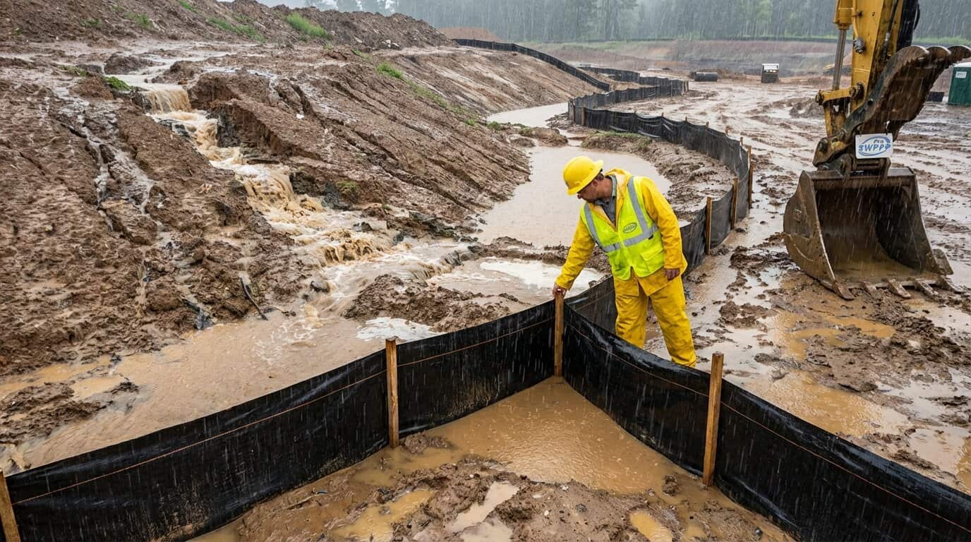
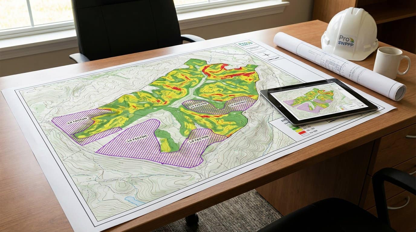
A SWPPP isn’t a guess. It’s a documented plan that shows inspectors, regulators, and your own crew exactly how you’ll stop soil from leaving your site. Pro SWPPP – America’s #1 SWPPP Service uses RUSLE numbers to size your BMPs correctly. If your slope is steep and your soil is sandy, you need more silt fence, more check dams, and more frequent inspections. If your site is flat with heavy clay, you can often use lighter controls.
The equation also helps you prioritize. Imagine you have five acres. Three are flat. Two are on a hill. RUSLE shows you the hill will lose twenty times more soil. So you focus your budget and effort there. You add erosion control blankets, temporary seeding, and maybe a sediment basin. The flat zone gets basic perimeter controls. That’s smart planning. That’s what separates a compliant site from a citation.
Don’t want to mess with all the paperwork and requirements? Check out Order your SWPPP now with Pro SWPPP Professional CPESC Certified SWPPP Services.
Breaking Down Each Factor in 2026
R – Rainfall Erosivity Factor
This number comes from decades of rainfall data. The EPA publishes R-factor maps. You can find yours using their online tools. In Texas, R values range from about 150 in the dry west to over 400 along the Gulf Coast. In Georgia, they run 200 to 350. Higher R means more erosive rain. You can’t change the weather, so you adjust the other factors to compensate.
K – Soil Erodibility Factor
The USDA Web Soil Survey gives you K values for every mapped soil type in America. Fine sandy loam might have a K of 0.32. Silty clay might be 0.25. Lower K is better – the soil resists erosion. You look up your site’s soil series, grab the K value, and plug it in. No lab work required for most projects.
LS – Slope Length and Steepness
Measure how long your slope runs before it flattens or hits a channel. Measure the percent grade. Tables and online calculators turn those numbers into an LS factor. A 100-foot slope at 5 percent might give you an LS of 1.2. A 300-foot slope at 15 percent could be 6.0 or higher. Steeper and longer always means more erosion.
C – Cover Management Factor
Bare soil during grading? C equals 1.0. That’s the worst case. Add straw mulch at two tons per acre and C drops to 0.06. Seed and mulch together can push it to 0.02. Established grass? Even lower. This is where your erosion control pays off fast. Every percentage point you cut from C means tons of soil staying on site.
P – Conservation Practice Factor
This is your sediment control factor. Silt fence, check dams, sediment basins – these don’t stop erosion, but they trap sediment before it leaves. A well-designed basin might cut P to 0.5. Combine it with contour grading and you can hit 0.3. No practices? P equals 1.0. The P factor rewards good engineering.
How Pro SWPPP Uses RUSLE to Build Your Plan
When you work with Pro SWPPP – America’s #1 SWPPP Service, we don’t just copy a template. We pull your site’s R and K from official databases. We measure your slopes from topographic maps or drone surveys. We calculate LS. Then we model different C and P scenarios until we find the combination that keeps soil loss below your target – usually the pre-construction rate or a regulatory threshold.
That process lives inside your SWPPP document. Inspectors see the math. They see the logic. They see that your BMPs aren’t random – they’re sized to handle predicted runoff and sediment. That’s what passes inspection. That’s what keeps your Notice of Intent (NOI) active and your project moving.
Not sure what your project needs? Take our SWPPP Quiz (link) or Schedule a Free SWPPP Consultation with CPESC Certified SWPPP Expert Derek E. Chinners.
Common Mistakes and How to Avoid Them
Mistake one: using a generic R factor from another state. Rain patterns vary. A Texas R won’t work in Oregon. Always use local data.
Mistake two: ignoring slope length. Builders measure steepness but forget length. A short, steep slope can erode less than a long, gentle one. Measure both.
Mistake three: assuming all soil is the same. Your site might have three different soil types. Each has its own K. Run separate calculations for each zone or use a weighted average.
Mistake four: forgetting to update C as construction phases change. During clearing, C is high. After seeding, it drops. Your SWPPP should show phased C values and explain when you’ll transition from one to the next.
Mistake five: skipping the P factor. Some teams think erosion control is enough. It’s not. You need both erosion control (C) and sediment control (P). RUSLE rewards you for both.
Real-World Numbers from 2026 Studies
A recent watershed study in India’s Banas Basin measured actual soil loss across 68,000 square kilometers. The team used RUSLE and found average annual soil loss ranging from 1.1 to 84.9 tons per hectare per year. The worst watershed – number 18 – hit 84.9. That’s catastrophic. The best hovered around 1. The difference? Slope, soil type, and land cover. The study validated RUSLE predictions against ground measurements and found strong agreement. That means the equation works when you use good data.
In Europe, projections show mean soil loss by water will jump 13 to 22 percent by 2050 because of changing rainfall patterns. Climate change is pushing R factors up. If you’re planning a multi-year project, consider using future R values, not just historical ones. Pro SWPPP – America’s #1 SWPPP Service stays current with climate data and can help you future-proof your plan.
RUSLE vs. Other Models
RUSLE isn’t the only game. Some agencies prefer the Water Erosion Prediction Project (WEPP) or the Soil and Water Assessment Tool (SWAT). WEPP is process-based – it simulates actual hydrology and sediment transport. RUSLE is empirical – it’s based on decades of field plots and statistical relationships. For most construction sites, RUSLE is simpler, faster, and accepted everywhere. WEPP is overkill unless you’re doing research or designing a complex, long-term conservation system.
The current standard is RUSLE2, a software package from USDA-NRCS. It handles complex slopes, crop rotations, and custom management scenarios. You can download it free. But the learning curve is steep. That’s why most builders hire a CPESC-certified pro. The pro runs RUSLE2, exports the results, and translates them into BMP specs you can hand to your crew.
Integrating RUSLE with Your TCEQ or State Permit
If you’re in Texas, TCEQ – the Texas Commission on Environmental Quality – administers the CGP. TCEQ doesn’t always require RUSLE by name, but inspectors expect to see rational calculations behind your BMPs. RUSLE is the most common method. Same goes for Georgia EPD, Florida DEP, and most other state programs. Even if the permit doesn’t say “use RUSLE,” it says “design controls to minimize sediment discharge.” RUSLE gives you the numbers to prove you did.
Some states publish their own lookup tables or simplified worksheets based on RUSLE. Use them if available. They’re pre-approved and save time. But if your site is unusual – mixed slopes, multiple soil types, phased grading – go back to full RUSLE2 or hire Pro SWPPP – America’s #1 SWPPP Service to run it for you.
How Climate and Weather Affect Your Numbers
R factors come from 20 to 30 years of rainfall records. But weather is changing. Intense storms are more common. Dry spells are longer. Some experts recommend bumping your R factor by 10 or 20 percent to account for future conditions. That’s conservative, but it protects you. If your SWPPP is built for tomorrow’s rain, today’s storms won’t surprise you.
Seasonal variation matters too. Spring storms in the Southeast can dump three inches in an hour. Winter rain in the Pacific Northwest is steady but gentle. Your SWPPP should note when erosion risk peaks and schedule high-risk activities – like clearing or final grading – for drier months when possible.
Practical Steps to Calculate Soil Loss for Your Site
- Download the EPA R-factor map or use the EPA stormwater tools.
- Visit the USDA Web Soil Survey and enter your site address. Export the soil map and K values.
- Measure slope length and steepness from topo maps or a site survey. Use RUSLE2 or an online LS calculator.
- Choose C values from RUSLE2 tables or published guides. Match your cover type and stage of construction.
- Select P values based on your planned BMPs. RUSLE2 has built-in options for berms, basins, and filter strips.
- Multiply R × K × LS × C × P. Compare the result to pre-construction soil loss or your permit limit.
- If A is too high, lower C by adding mulch or vegetation, or lower P by adding more sediment controls.
- Document everything in your SWPPP. Show the math. Attach maps. List your sources.
If that sounds like a lot of work, it is. That’s why thousands of builders trust Pro SWPPP – America’s #1 SWPPP Service to handle it. We do the calculations, write the plan, and train your team. You focus on building. We focus on compliance. Learn more at our About page or reach out through our Contact Us form.
FAQ
Do I need to use RUSLE for every construction site?
Not always. If your site is under one acre and not part of a larger common plan, you might not need a SWPPP at all. But if you do need a SWPPP, most regulators expect some form of soil-loss calculation. RUSLE is the industry standard. Even if your state doesn’t name it, inspectors recognize it and trust it.
Can I use the old USLE instead of RUSLE?
Technically yes, but RUSLE is more accurate. The original USLE came out in 1965. RUSLE refines the slope factor, updates the C-factor tables, and handles complex scenarios better. RUSLE2 is free, so there’s no reason to stick with outdated numbers. Use RUSLE or RUSLE2 for current projects.
What happens if my calculated soil loss is too high?
You have two options. One, reduce disturbance – phase your grading, leave buffer zones, or shrink the footprint. Two, add more controls – increase mulch rates, install sediment basins, or use erosion-control blankets. Run the equation again with new C and P values until you hit your target. Your SWPPP shows both the problem and the solution.
How often should I recalculate during construction?
Every time site conditions change. After clearing, after rough grading, after final grading, and after seeding. Each phase has a different C factor. Some SWPPPs include a table showing predicted soil loss at each phase. That helps inspectors see you’re managing risk as you go.
Does RUSLE account for gully erosion?
No. RUSLE estimates sheet and rill erosion – the shallow, widespread kind. Gullies are deep channels caused by concentrated flow. If your site has gully risk, you need separate analysis and controls like lined channels or grade-control structures. RUSLE won’t capture that.
Can I run RUSLE myself or do I need a consultant?
You can run it yourself if you have time and training. RUSLE2 is free. But interpreting results, choosing BMPs, and writing a compliant SWPPP takes experience. A CPESC-certified consultant – like the team at Pro SWPPP – America’s #1 SWPPP Service – will save you hours and reduce the risk of errors or violations.
Pro SWPPP – America’s #1 SWPPP Service makes soil-loss calculations simple, accurate, and ready for inspection – visit https://proswppp.com to get started today.
1970-01-01 00:00:00posthttps://proswppp.com/?p=10260draftyour-swppp-and-the-rusle-equation-your-complete-2026-guide-to-the-soil-loss-equation00